 |
| Figure 1.1 - Current iteration of the Transport for London Underground map (2010) |
 |
| Figure 1.2 - Beck's Underground Map is first published (1933) [1] |
 |
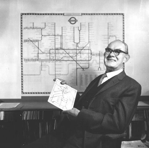
| Figure 1.3 - Harry Beck (1965) [1] |
 |
| Figure 1.4 - First sketch of Beck's underground map (1931) [1] |
'Harry' Beck's Underground Map Evolves
In 1931 'Harry' Beck (see Figure 1.3) produced the first sketch of his underground map (see Figure 1.4). It was first published in 1933 (see Figure 1.2) in the form of a DL flyer leaflet, a card folded twice vertically down a landscape page. In doing so, the leaflet stood upright and portrait. Beck continued to make further iterations of the map until 1959 [1]. In its current form the Transport for London (TfL) Underground map (see Figure 1.1) acknowledges Beck's original design at the bottom right of the map.
It appears that quite sometime prior to TfL, separate rail companies operating different rail networks above and below ground within and around London, merged and formed the Underground Group (UG). It is also likely that the UG had to absorb the financial jostling, within a changing rail network market place, of certain companies within the group.
According to Garland the initial maps designed by different companies within the UG were complex spider schematic diagrams that simply confused the general public; and at a time when certain companies within the UG were in what appears to be financial upheaval, hiring and laying off staff sporadically. Some of the UG companies schematics echoed the complexity of the underground network and tried to overlay this on to a geographically accurate map [1]. It seems that what Beck realised, was that people navigating this complex underground network only needed to know three things: where they were; where they wanted to go; and in what direction they needed to travel. The public pounced at the introduction of the Beck adaption [1]; even today, speaking from personal experience, you know you can get home if you can see an underground sign on a London street.
It is for this reason that I am passionate about simplifying complex information in a way that is intuitive and accessible to every person. In addition to this, I also want to help people find the information they require as and when they need it.
This blog was based on the work of Garland 1994 [1], Mr Beck's Underground Map , and can be purchased from Amazon for £12.95.
References:
[1] Garland, K. Mr Beck's Underground Map, a history by Ken Garland, Capital Transport Publishing, Harrow, 1994, pp.6-62.
Figure References:
1.1. http://www.tfl.gov.uk/assets/downloads/standard-tube-map.pdf
1.2. https://blogger.googleusercontent.com/img/b/R29vZ2xl/AVvXsEh6oy0eVdUnyHnbWxXp9oLs_xCbKJCeJ44RbFA7kIoA_NMdo8fXWsJ56Gv6DGnKUofrluQnjzXvz0BMrfOHbnfEO8CkRgRTDXtzovNc7yW7kmS50w7x1KcTNAtKAl9-ouVBuZmsbyBqPGM/s1600/beck_map%5B1%5D%5B1%5D.jpg
1.3. http://harrybeck.com/beck2.jpg
1.4. http://www.kerinsnaumov.com/texts/2008/images/londonsketch.jpg
No comments:
Post a Comment